Not a formal unit, just a very dangerous combination of skills
ELDIAN
KNIGHT
A multidisciplinary team building spatial intelligence, AI decision support systems, and digital governance platforms for governments, institutions, and strategic partners.
Relevant Experience
Our team members have contributed to research, digital transformation initiatives, product development, and innovation projects across academia, government, and industry.
ITB
Academia
UrbanSolv
Industry
Pertamina
Industry
KKIP
Public Sector
BGN
Public Sector
ICESCO
Innovation
These organizations represent environments where our team members have contributed through professional work, employment, research, innovation programs, or project collaborations, and do not necessarily imply official endorsement.
Why We Matter
Spatial Problem Solvers
We transform maps, assets, infrastructure, and operational data into actionable insights that support planning and decision making at every level of governance.
Government-Oriented Thinking
We understand that public sector solutions must be transparent, auditable, practical, and easy to adopt across multiple stakeholders and institutional layers.
Beyond Visualization
We build complete decision support systems by integrating WebGIS, AI, analytics, dashboards, and workflow automation — not just maps, but decisions.
About Us
WebGIS
End-to-end spatial platforms
Digital Twin
3D infrastructure modeling
AI Decision Support
Intelligent recommendation engines
Spatial Analytics
Location-based insight systems
Eldian Knight is a multidisciplinary technology team that converged from a shared professional environment and a common conviction: that spatial data, applied intelligently, can fundamentally improve how institutions plan, operate, and make decisions.
Our team brings together expertise in spatial engineering, system analysis, artificial intelligence, and product design — disciplines that rarely coexist in a single team, but are all essential for building practical digital governance solutions.
Our delivered work spans Urban Digital Twin platforms, Asset Intelligence systems, and Spatial Market Intelligence tools — each built to answer a specific operational question, not to demonstrate technology for its own sake.
We do not sell software. We help organizations understand real problems, validate them in the field, and build decision support systems that stakeholders can actually use.
Current Initiative
SIGAP MBG
Smart Vendor Licensing & Oversight Platform
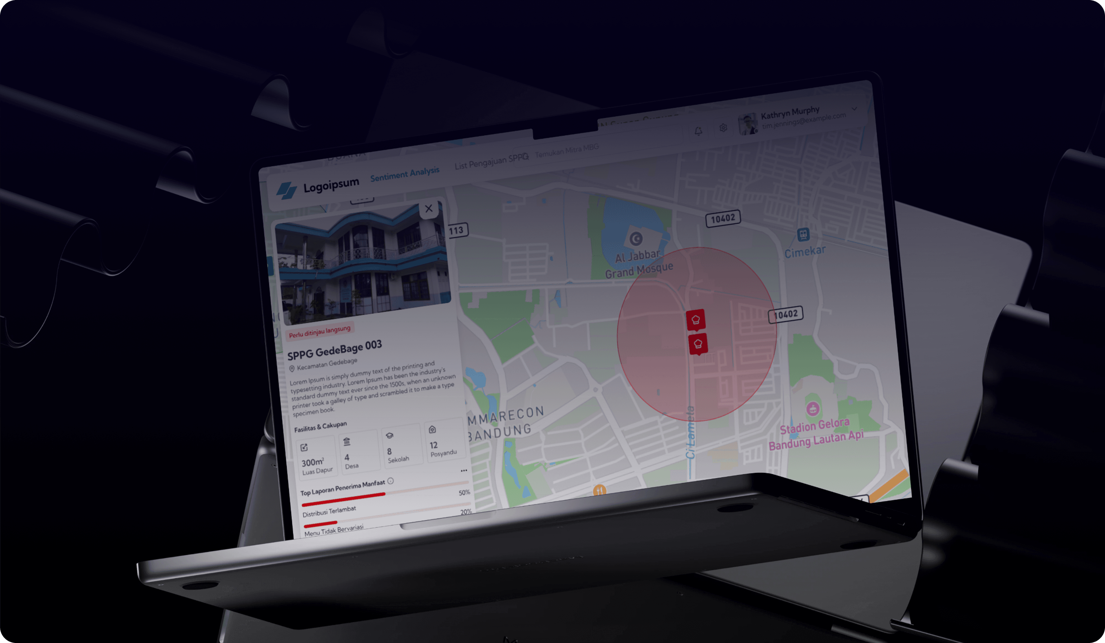
SIGAP MBG is our ongoing initiative to support vendor registration, spatial assessment, operational monitoring, and risk-based oversight within Indonesia's Free Nutritious Meals ecosystem.
The platform is designed to help government institutions make more informed, transparent, and data-driven decisions by integrating:
- WebGIS Integration
- Spatial Risk Assessment
- AI-assisted Oversight
- Monitoring Dashboard
Sumedang
West Java, Indonesia
Why Sumedang?
Sumedang was selected as the initial validation area due to its active and well-documented MBG implementation ecosystem and the collaborative posture of its local stakeholders. This combination makes Sumedang a practical validation environment where real operational data, institutional partnerships, and field conditions can directly inform the platform's design — ensuring that solutions are grounded in practice before broader regional adoption.
Experience Highlights
Digital Products
Built and shipped
Spatial Intelligence Projects
WebGIS & geospatial
Decision Support Systems
AI-integrated platforms
Core Team Members
Multidisciplinary expertise
Our Journey
Eldian Knight grew from shared professional context, overlapping expertise, and a common belief that spatial intelligence and AI — applied with rigor — can meaningfully improve how organizations make decisions.

Convergence
A team of professionals with complementary expertise — spatial engineering, system design, AI development, and product design — connected within the same organization, drawn together by shared thinking on location-based problem solving and data-driven governance.
Structuring the Vision
Collaboration became intentional. Each member's distinct capability — spatial data architecture, system analysis, AI engineering, and UX strategy — began to form a coherent whole. The team aligned on a shared direction: build practical solutions for real institutional problems.
Building Practical Solutions
Eldian Knight formalized its approach: identify real operational problems, validate them with stakeholders, and build decision support systems that are transparent and adoptable. SIGAP MBG became the team's first strategic initiative, currently undergoing stakeholder validation.
Convergence
A team of professionals with complementary expertise — spatial engineering, system design, AI development, and product design — connected within the same organization, drawn together by shared thinking on location-based problem solving and data-driven governance.
Structuring the Vision
Collaboration became intentional. Each member's distinct capability — spatial data architecture, system analysis, AI engineering, and UX strategy — began to form a coherent whole. The team aligned on a shared direction: build practical solutions for real institutional problems.
Building Practical Solutions
Eldian Knight formalized its approach: identify real operational problems, validate them with stakeholders, and build decision support systems that are transparent and adoptable. SIGAP MBG became the team's first strategic initiative, currently undergoing stakeholder validation.
Our Portfolio
Each project addresses a specific operational problem. Every solution is built to support decisions, not just display data.
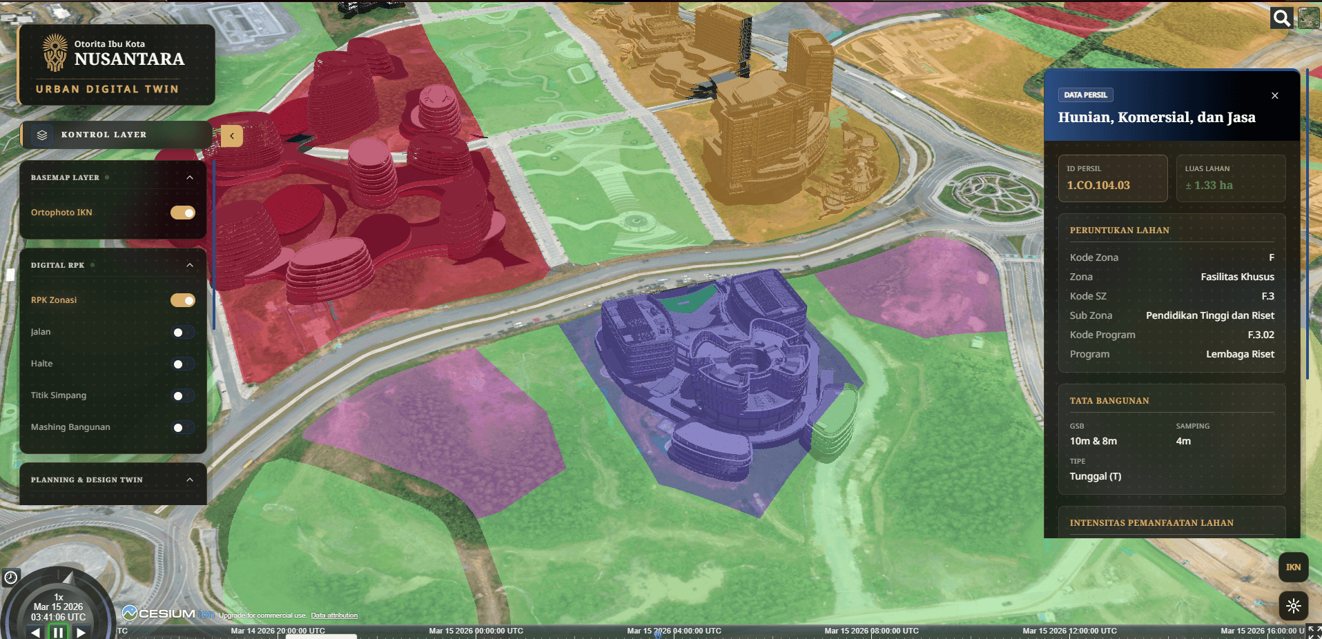
Urban Digital Twin
Complex urban infrastructure data scattered across disconnected systems with no unified planning interface.
3D Digital Twin platform integrating real-time spatial data, satellite imagery, and infrastructure overlays.
Supports urban planning, infrastructure monitoring, and scenario analysis for institutional decision makers.
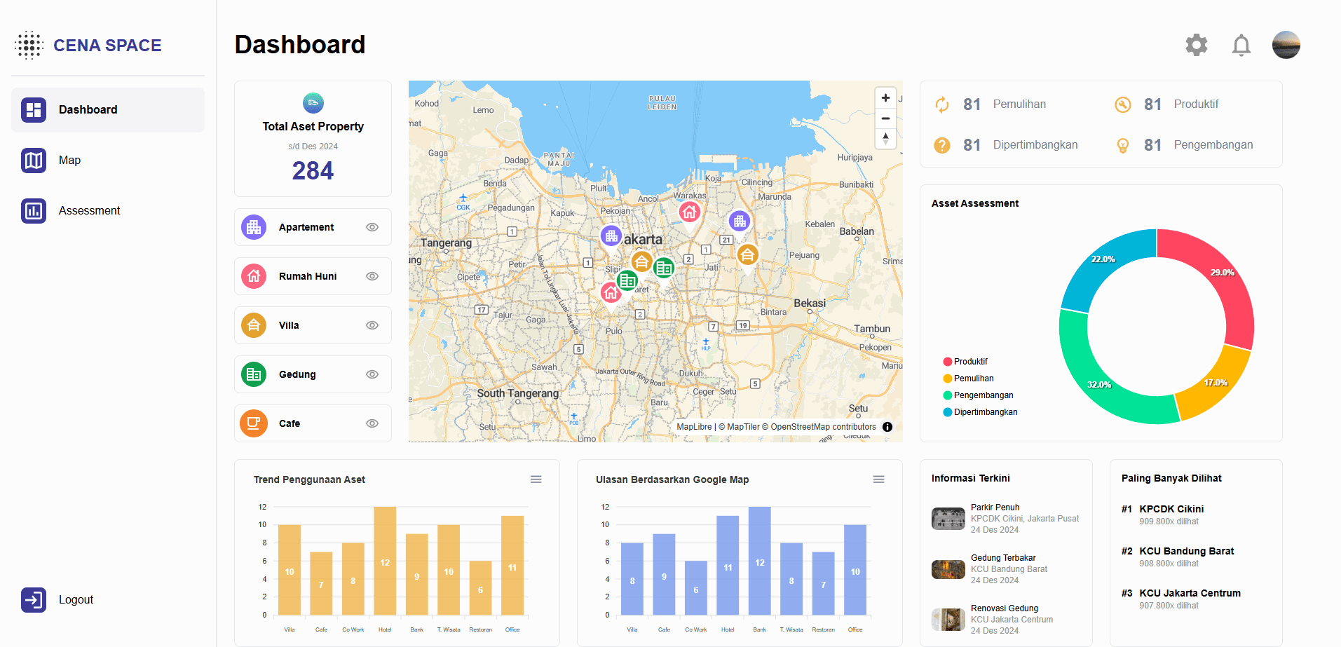
Asset Intelligence
Asset data fragmented across siloed databases with no spatial context or predictive capability.
AI-powered spatial dashboard with geospatial analytics, 3D visualization, and predictive insights.
Accelerates monitoring cycles and enables data-driven investment and maintenance decisions.
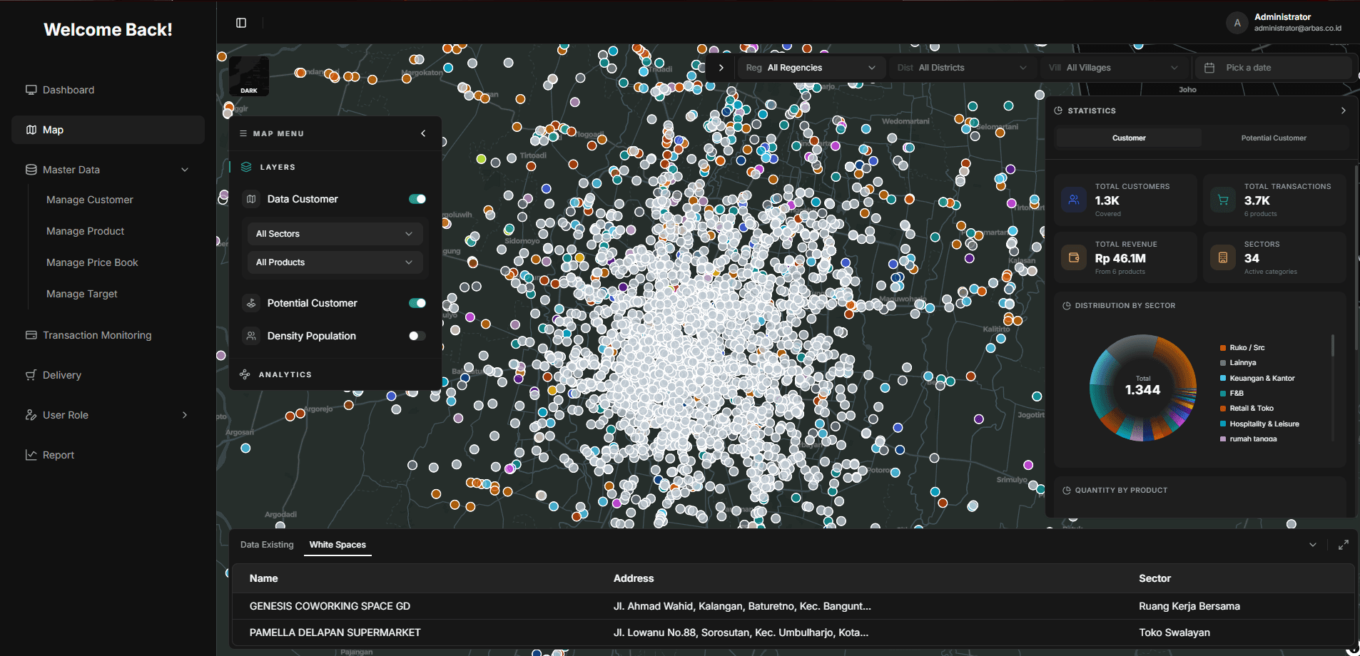
Spatial Market Intelligence
Market opportunity identification reliant on manual surveys and geographically incomplete data.
Location intelligence platform combining spatial analytics, clustering, and geospatial AI.
Supports evidence-based business expansion, site selection, and resource deployment decisions.
How We Work
A structured approach from problem framing to decision-ready systems — no shortcuts, no assumptions.
Understand the Problem
Stakeholder interviews, field validation, and operational context mapping to frame the right questions before building anything.
Map the Data
Spatial data integration, source architecture, and geospatial layer design to establish the intelligence foundation.
Build Intelligence
WebGIS platforms, AI models, dashboards, and analytics systems assembled around the specific decision problem.
Deliver Decision Support
Actionable systems delivered to decision makers — transparent, auditable, and designed for institutional adoption.
Meet The Team
Four specialists. One shared conviction: that spatial intelligence and AI can solve real institutional problems when applied with rigor and purpose.

Valdi Firstianto
S.PWK., M.PWK.
Fullstack WebGIS Engineer
Urbansolv
“Bridging spatial data to actionable governance dashboards.”

Riri Annisatunnaza
S.Kom.
System Analyst
Urbansolv
“Translating real operational needs into resilient system architectures.”

Muh Nur Aslam
S.Kom., M.Kom.
AI Engineer
Urbansolv
“Building AI models that understand and reason within geospatial context.”

Rafly Firmansyah
UI/UX Designer & Frontend Engineer
Urbansolv
“Transforming data complexity into intuitive, decision-ready interfaces.”
Let's Validate Real
Problems Together
We collaborate with governments, universities, research institutions, and industry partners to transform complex operational problems into practical digital solutions powered by WebGIS, Spatial Intelligence, and Artificial Intelligence.